Monday, 30 July 2018

Magical Kakadu Part 1

Goodness, it’s already ten days since my last post . . . and finally I can talk about my remarkable time in the famous Kakadu National Park, where so many of our unique Australian bird species can be found. 

Fortunately, like many of our significant parks, Kakadu is under the management of Aboriginal people, who are so much better at looking after the land and its wildlife in a sustainable way than most other Australians. 

I was a little surprised when we entered the park, as having hear about its rich birdlife I mistakenly thought it would be more densely wooded, but very soon I realised it is a wetlands. We went on a memorable cruise on a billabong, and  while we saw trees, the landscape was dominated by grasslands and shrubs. There were lots of reeds and native waterlilies along the waterways, and an abundance of different kinds of waterbirds, despite the presence of crocodiles in the water. And there were also eagles in the trees. It was just a magical, almost ethereal, kind of beauty. I just love birds! And flowers! So I was in my heaven. 

What I could not believe was the other passengers in our boats who kept draping their hands over the sides of the boats, which did not rise far above the water, despite the warnings from our special guides to keep their arms and hands totally inside in case a crocodile came close. If they had seen the jumping crocodiles I saw just outside Darwin (see my earlier post), then perhaps they would have been more careful. But lucky for them, no-one suffered any consequences for their foolishness. 

Mind you, it would be even more dangerous in the Wet Season when much of the area floods and crocodiles can access just about everywhere.

On the way to Kakadu we saw some remarkably tall termite mounds, so my first photo shows you one of these. Over our whole journey, we saw countless termites mounds of different colours and shares and sizes. While termites (or white ants, as they are commonly called) can quickly destroy the timber in houses and other structures in built-up areas, here they play a very important role in the ecosystem.  

I hope you enjoy the photos of some of the remarkable birds and flowers I saw. It was quite difficult to photograph them as both the boat and the birds were constantly moving, so I had to try to zoom in on them very quickly. I have added the warning sign for crocodiles and a photo of one of the crocodiles we saw as well. We saw many such warning signs in the area. 


I think this was a sea eagle. It was very high up in a tree.


These birds in particular captivated me as they walked across the lily pads - but so very quickly. 


Drying off its feathers.

Friday, 20 July 2018

From the Kimberley to the Northern Territory and Katherine Gorge

After our very bumpy long ride out of the Bungle Bungles, during which we saw a few broken down vehicles, we travelled through some more rich red landscapes to the eastern ‘gateway’ to the Kimberley - the town called Kununurra. Along the way we saw some of the Ord River, which is part of an incredible irrigation scheme that has allowed huge tropical plantations to be developed. Mangoes, for example, are grown here. As well there are pastoral lands, with cattle stations along the river as well. 

As we drove past the river, we were told a very sobering story. Some men were travelling along the river in their boat when they spotted what they thought was a cow stuck in the mud on the embankment. When they got closer, they realised the cow was stuck alright, standing bolt upright, but missing its head! A crocodile had taken it! 

We had a great picnic lunch in the ground of the Zebra Rock Gallery, and were most intrigued with the very unusual rocks of all sizes on display here. These were found locally and we soon could see why they were called ‘zebra’ rocks. They look like they have been hand-painted.

After a short wander around the town of Kununurra, where many shops were selling the famous, beautiful Argyle diamonds that are mined near there, we stayed at the local Country Club Resort. What bliss after all our nights in freezing cold tented cabins! And we could even call home. 

It was so sad to know that was to be our last night in the magnificent Kimberley! The Kimberley region is simply spectacular - in my view, one of the most stunning beautiful, rugged places in the world! (I was lucky enough to sail along the Kimberley coast again on another trip, this time along the coast of Western Australia and through the Pilbara, but that is a story for another time.) 

The next day we crossed the state border from Western Australia into the Northern Territory, to go to the stunning Nitmiluk National Park - the famous series of gorges more commonly known as Katherine Gorge. I had seen this on an off-train excursion as I travelled to Darwin on the Ghan (see my earlier story about that), but this time we went on an unforgettable ‘Nabilil Dreaming Sunset Cultural Cruise’ run by the Aboriginal people who manage the park. We cruised even further along the series of spectacular gorges, which glowed an even richer red as the sun dipped lower in the sky. The red cliffs were mirrored in the water as well, creating a beautiful panorama. Then, as we enjoyed a gourmet dinner on board, we watched the sun finally set over the water in the distance. What a magical sight! And a magical night! 

That night we stayed in a hotel in the township of Katherine. Another night of luxury before we headed off the next morning to the Kakadu National Park and more tented cabins . . .     

The first photos were all taken at Zebra Rock Gallery and in its gardens.


Crossing the border:


The remaining photos were taken on our sunset cruise in Katherine Gorge.


Thursday, 5 July 2018

Across the Kimberley Part 11 - The Bungle Bungles and Cathedral Gorge

After receiving a great welcome and spending a very pleasant evening at the Bungle Bungle Wilderness Lodge, again in tented cabins, the next morning we were forced to wait our turn to hike along Piccaninny Creek into Cathedral Gorge. ‘Piccaninny’ is an Aboriginal name for a baby. The shape of part of the creek is rather like that of a birth canal. 

The problem with our delayed departure was that by the time we left the campsite it was around 40 degrees Celsius, which made the long hike (a few kilometres) very challenging.  It would have been far better to set off at sunrise! Part of the reason for the delay was there were a couple of other groups staying there as well, and many of the guests were taking turns to be driven to the spot where they were able to take off in helicopters for a spectacular flight over the park. 

However, one upside of this hike was that we had a fantastic Aboriginal guide who had a great sense of humour, and passed on to us some of the very ‘naughty’ Aboriginal jokes about how the shapes of certain outcrops and other geological features resembled particular male and female body parts. We laughed our heads off when he told us the English translations of the names they gave these features - and so did he! 

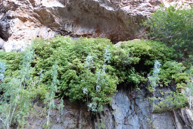
The other of course was the sheer beauty of the place, with its rich red cliffs, brown rocks and pale green vegetation, and occasionally some running water. We walked through quite rugged terrain and saw many of the striped ‘beehives’. It was great when we walked through a chasm that afforded a little shade and so some relief from the relentless heat, and especially wonderful to reach the massive cave-like Cathedral Gorge, where at last we could rest and enjoy a picnic lunch. 

Surprisingly, the ‘floor’ of Cathedral Gorge was made up of white sand with an intriguing pool in the centre that kept changing its shape and size and clarity. Clearly there must have been some kind of water source and drainage system below it, but we could not see them.  

I believe a concert has been held here - how amazing that would be, with the sound echoing off the huge walls and making its way out into the total silence of the bush! 

But by now it was really, really hot, and I must confess I started to feel very faint over the last few hundred metres back to our bus. Our guide was wonderful though, and sat me down and put wet cloths around my neck and gave me water until I was up to the last part of the hike. 

That evening, before spending our second night at the Lodge, we went to watch the changing colours of a distant rock formation as the sun set behind us. It went from red to a purple colour, rather like Uluru does. We sat on camp chairs enjoying the views, champagne and other drinks and nibbles in hand. A very civilised and picturesque end to a memorable day. 


Some of the striped 'beehives'. 

One of the native plants.

A very awe-inspiring chasm - and a welcome relief from the sun. 

Cathedral Gorge.

Looking up at the sheer height of this cave-like structure, and its unusual rock formations.

My first look at the pool.

As I sat there with my picnic lunch, I noticed an oval mirror-like shape suddenly appear on the surface of the pool.

Some of the pool acted like a mirror, the rest did not! A most unusual phenomenon.

We saw this sign and the rock to which it refers (shown below) as we hiked back. Most interesting to see the apparent sculpturing of the rock - some very smooth, some pitted. The forces of Nature! We had to walk very carefully around it. 


A water-hole seen on our journey back to the bus.

The rock formation on the left reminded us of an elephant.

The next photos show our views of distant rocks as the sun set behind us. 


Wednesday, 4 July 2018

Across the Kimberley Part 10 - Off to the 'Bungle Bungles'

The next morning we left El Questro, after seeing the early sun light up the spectacular escarpment that rises up behind it. What an incredible sight! My first photos below show the campsite and this escarpment. 

We drove back along the old Gibb River Road and then headed towards the immense and now famous range commonly known as the ‘Bungle Bungles’ situated in the World Heritage listed Purnululu National Park.  “Bungle Bungles’ is an extraordinary, almost quirky name, but then the range does rather look like a quirky accident of nature, with its orange and black-striped mounds that rather resemble beehives. These cones, which are made up of sandstone and conglomerates, formed from stacks of ancient seabeds which were then subjected to land movement through fault lines, and weathering by strong winds and water. They rise about 250 metres above semi-arid grasslands. Amazingly, some trees cling precariously to them. How they find any soil for their roots is astonishing. 

The orange stripes are due to the presence of iron minerals and the black stripes are due to layers of more porous sandstone that has retained water, allowing algae and cyanobacteria to thrive. We saw these black regions around the Kimberley coastline as well, especially around the waterfalls. 

Aerial images of these unique formations that I have seen on the internet look absolutely stunning! Many of our group were fortunate to be able to take flights over then and capture amazing shots of them. 

Interestingly, while the Bungle Bungles were formed around 350 to 375 million years ago, occupy an area of about 450 square kilometres, are visible from Space, and Aboriginal people have lived among them for over 40 000 years, they were only ‘discovered’ by the rest of us Australians in 1983, when a documentary of the Kimberley was being made. What a well-kept secret! It was declared a World Heritage Area in 2003. 

Fortunately the Bungle Bungles are under the control of the Jaru and Gidja people, the traditional custodians of Purnululu National Park. We were to be guided to one of the best known gorges within the park by one of these Aboriginal custodians the next day. He was fantastic! More of that in my next post! 

In the meantime, the photos below show a little of what we saw on the very long and exceptionally bumpy drive into the park. Talk about bone-shaking! We just clung on to our seats! (We saw quite a few vehicles with broken axles along the way. This is no place for cars or caravans! ) 


Some of the tented cabins at El Questro. (The luxurious accommodation is in another section.) 

This is the back of my cabin, where the shower etc. are. The front has canvas walls. 

A pool and recreation area.

The early morning sun revealed the huge escarpment behind our cabins. 

Our last glimpse of El Questro.

Out of the El Questro region and off to the Bungle Bungles.

A typical sight and set of signs along the road.

At the entrance to Purnlulu National Park.

Our first glimpse of the park - on its outskirts.

The typical cone-shaped rocks, though the stripes were not evident in this section of the park.


Interesting rock formations.

Incredibly resilient palm trees growing on the rocky faces.